Statistics and Information about Concepcion, Iloilo
[Location and Accessibility] Concepcion in Focus
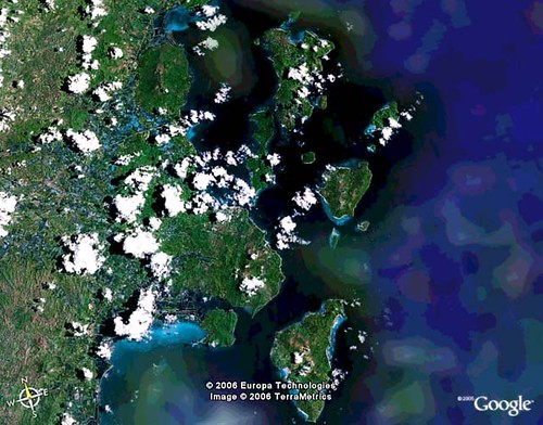
- 108 kilometers from Iloilo City, it is located in the east of Panay Island and northeast of Iloilo Province. It is Bounded in the east and south by Visayan Sea, in the north by Municipality of San Dionisio and in the west by the Municipality of Ajuy and Municipality of Sara.
- Concepcion is politically divided into 25 barangays, 14 of which are located on the mainland and 11 in 16 islands scattered throughout Concepcion's waters.
- Land Area - 97.02 sq. km. or 9,702 hectares
- Area of Territorial Waters - 22.2 sq. km. or 22,200 hectares
- Topography - The Mainland of Concepcion follows a lowland upland pattern the Southeastern portion is characterized by thin areas of lowlands starting from the coast giving way to low slightly rolling hills which gradually rise to steeply hills converging at the slopes of Mt. Apitong, Clustered around this mountain are the Barangays of Nipa, Loong, Poblacion, Tamis-ac, Nino, Macalbang and Plandico, covering about 56% of the mainland area. By and large the island of Concepcion are highland masses except Baliguian which is a Coral Reef. They appear as half drowned mountains jutting out from the sea and manifested by sedimentary rocks. The mountain and hill system are so close to the sea that only very narrow strips of level land bordering the shores where the islanders built there clustered homes.
- Population Projection - 40,908 (2006 projection)
- Population - 34,320 (2000 Census)
- Households - 6,435(2000 Census)
- Population growth rate - 2.97%
- Density - 598 people / sq. km
- Dominant Religion - Roman Catholic & Aglipa
- Tertiary Schools - 1
- Secondary Schools – 1
- Elementary Schools – 17
- Primary Schools - 9
- 2004 BIR tax collection - P2,322,292
Read more of Concepcion's Tourism and History